Climate Technologies for Cities: How Sensors, Digital Mapping and Automation Reduce Urban Overheating
Urban overheating has become one of the most significant environmental challenges facing cities in 2026. Dense construction, extensive asphalt surfaces, limited vegetation and increasing global temperatures contribute to the urban heat island effect, where metropolitan areas remain noticeably warmer than surrounding regions. To address this problem, municipalities are increasingly adopting climate technologies that combine real-time monitoring, geospatial analysis and automated management systems. These tools help city authorities identify heat risks, improve public spaces and make evidence-based decisions that protect residents, infrastructure and local ecosystems.
How Sensor Networks Help Cities Monitor Heat in Real Time
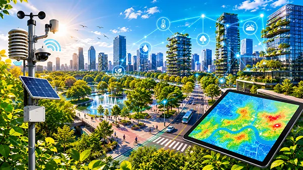
Modern climate monitoring systems rely on thousands of connected sensors installed throughout urban areas. These devices measure air temperature, surface temperature, humidity, solar radiation, wind speed and air quality. Unlike traditional weather stations, which may only provide information from a limited number of locations, distributed sensor networks create a detailed picture of microclimates across entire cities.
Many European cities now place sensors on streetlights, public buildings, transport infrastructure and green spaces. This approach allows local authorities to identify neighbourhoods where temperatures rise significantly during heatwaves. Areas with little vegetation, large concrete surfaces and heavy traffic often record the highest temperatures and therefore require priority intervention.
The data generated by these systems is transmitted continuously through wireless communication networks and analysed using cloud-based software. City planners can access dashboards showing current conditions, historical trends and predicted heat patterns. This enables faster responses to extreme weather events and supports long-term climate adaptation strategies.
Practical Applications of Urban Climate Sensors
One of the most important uses of sensor networks is the management of public health risks. During periods of extreme heat, authorities can identify vulnerable districts and activate emergency measures such as cooling centres, additional drinking water stations and public health alerts. Real-time information helps ensure that resources are directed where they are most needed.
Sensor data is also used to evaluate the effectiveness of climate adaptation projects. After planting trees, installing reflective surfaces or creating new green corridors, municipalities can compare temperature measurements before and after implementation. This evidence-based approach allows investments to be assessed using measurable results rather than assumptions.
Transport authorities increasingly rely on environmental sensors as well. High temperatures can affect roads, rail infrastructure and public transport operations. Continuous monitoring enables maintenance teams to identify potential risks earlier and reduce disruptions caused by heat-related damage.
The Role of Digital Heat Maps in Urban Planning
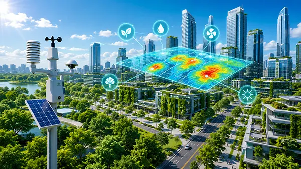
Digital mapping technologies have transformed the way cities understand and manage overheating. Using satellite imagery, aerial surveys, LiDAR data and geographic information systems (GIS), specialists can create detailed heat maps that reveal how temperatures vary across different urban environments.
These maps highlight hotspots where buildings, roads and industrial areas absorb and retain large amounts of heat. They also identify cooler zones created by parks, rivers, lakes and tree-covered streets. By comparing these areas, urban planners gain valuable insights into how land use affects local temperature conditions.
In 2026, many city administrations integrate heat maps into broader digital twin projects. A digital twin is a virtual representation of urban infrastructure that combines environmental, transportation and energy data. By incorporating heat information, decision-makers can simulate the impact of future developments before construction begins.
Using Geospatial Analysis to Design Cooler Cities
Heat mapping supports more effective urban design by identifying locations where cooling measures can deliver the greatest benefits. For example, planners may determine that a specific district requires additional tree planting, shaded pedestrian routes or redesigned public spaces to reduce heat exposure.
Digital maps are also used when selecting materials for new developments. Reflective roofing systems, permeable pavements and light-coloured construction materials can significantly reduce surface temperatures. Mapping technologies help engineers evaluate where these solutions are likely to produce the strongest results.
Another important application involves social and environmental equity. Heat maps often reveal that lower-income communities experience greater exposure to extreme temperatures due to limited green infrastructure. Cities can use this information to prioritise investments and improve living conditions for residents facing the highest climate-related risks.
How Automation Supports Urban Cooling Strategies
Automation is becoming an essential component of climate-resilient cities. Instead of relying entirely on manual decision-making, municipalities increasingly deploy automated systems capable of responding to changing environmental conditions. These technologies process sensor data and trigger actions without requiring constant human intervention.
Smart irrigation systems provide a clear example. Connected to weather forecasts and soil moisture sensors, these systems automatically adjust watering schedules for parks, green roofs and urban forests. This reduces water consumption while maintaining vegetation that helps cool surrounding areas through evapotranspiration.
Automated building management systems also contribute to temperature reduction. Modern public buildings use intelligent controls to regulate ventilation, shading and energy consumption based on occupancy levels and external weather conditions. This improves thermal comfort while reducing energy demand during heatwaves.
The Future of Automated Climate Management
Artificial intelligence is increasingly used to analyse large volumes of environmental data and predict heat-related risks before they occur. Machine learning models can identify patterns that may not be visible through traditional analysis, helping authorities prepare for extreme weather events with greater accuracy.
Smart public infrastructure is another rapidly developing area. Some cities already operate adaptive street lighting, automated shading structures and responsive water features that activate when temperatures exceed predefined thresholds. These systems improve public comfort while optimising resource use.
As climate pressures continue to increase, the integration of sensors, digital mapping and automation will play a central role in urban adaptation. Cities that invest in these technologies gain more accurate information, stronger planning capabilities and faster operational responses. Together, these innovations create safer, healthier and more resilient urban environments capable of addressing the growing challenge of overheating.